Fossils on the Island of Malmøya
Malmøya, a tranquil island jewel nestled within Oslo’s Bunnefjord, is globally revered by geologists as an exceptional open-air archive of the Cambro-Silurian period. Spanning a rich timeline from roughly 440 million years ago, this pristine terrain allows visitors to walk across what was once a warm, tropical seabed located 15 degrees south of the equator. Through continental drift and structural upheaval, this ancient world has been perfectly preserved, offering a sophisticated look into Earth's primordial past.
The Lithological Blueprint: Knollekalk and Volcanic Dykes
The island forms a critical anchor of the celebrated Oslo Rift Valley (Oslofeltet). Walking along its wave-swept shores reveals a remarkably clear layer-cake of Earth's history:
The Layered Sediments: The bedrock features striking formations of interbedded shales, sandstones, and the famous knollekalk (nodular limestone). These distinct rock structures yield invaluable data regarding prehistoric sea levels, tidal changes, and shifting oceanic currents.
Permian Magmatic Intrusions: The prehistoric seabed is vividly sliced by dramatic diabase dykes. These dark, volcanic veins forced their way through the older sedimentary crust roughly 290 million years ago, leaving behind a stark, high-contrast signature of ancient volcanic activity.
Glacial Striations: The exposed coastal rocks showcase polished, linear grooves. These clear abrasions were carved into the stone by moving sheets of ice during the last Ice Age, roughly 10,000 years ago.
A Chronology of Fossil Wealth
For more than a century, international paleontologists have journeyed to Malmøya to study its exceptionally well-preserved biological specimens. The island's diverse rock formations—such as the Solvik, Rytteråker, and Malmøya formations—serve as a vault for a vanished marine ecosystem.
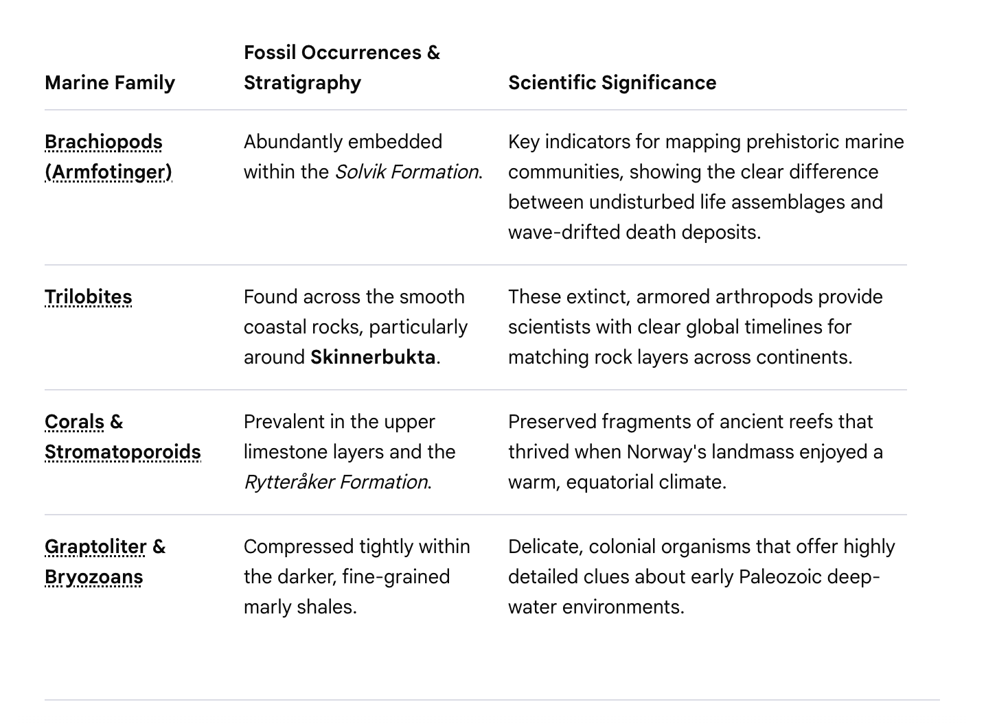
Marine FamilyFossil Occurrences & StratigraphyScientific SignificanceBrachiopods (Armfotinger)Abundantly embedded within the Solvik Formation.Key indicators for mapping prehistoric marine communities, showing the clear difference between undisturbed life assemblages and wave-drifted death deposits.TrilobitesFound across the smooth coastal rocks, particularly around Skinnerbukta.These extinct, armored arthropods provide scientists with clear global timelines for matching rock layers across continents.Corals & StromatoporoidsPrevalent in the upper limestone layers and the Rytteråker Formation.Preserved fragments of ancient reefs that thrived when Norway's landmass enjoyed a warm, equatorial climate.Graptoliter & BryozoansCompressed tightly within the darker, fine-grained marly shales.Delicate, colonial organisms that offer highly detailed clues about early Paleozoic deep-water environments.
Preserving a Precious Heritage
Because of its immense scientific importance, the island is strictly protected under the Malmøya og Malmøykalven Nature Reserve guidelines.
To protect this fragile environment for the future, the use of geological hammers, chisels, or any tools to extract specimens from the bedrock is strictly forbidden. Visitors are warmly invited to explore the island as a living museum—observing, photographing, and admiring the ancient sea floor exactly where time has laid it bare.
Pioneers of the Oslo Rift: The Historical Stratigraphy of Johan Kiær
The exceptional geological clarity of Malmøya is deeply intertwined with the birth of modern European paleontology. In the late 19th and early 20th centuries, the Oslo Region (Oslofeltet) became a focal point for international researchers deciphering the Paleozoic Era.
The true architectural pioneer of Malmøya's strata was the legendary Norwegian paleontologist Johan Aschehoug Kiær (1869–1931). After completing his doctorate in Munich, Kiær returned to the University of Oslo and dedicated his career to meticulously mapping the Silurian layers of the region. His monumental 1908 work, Das Obersilur im Kristianiagebiete ("The Upper Silurian in the Oslo Region"), systematically cataloged Malmøya's rocks into numbered, chronologically precise zones.
Kiær’s sharp field observations cracked open a profound realization: Malmøya was the definitive type locality for multiple lower Paleozoic formations. On these very shores, Kiær unearthed massive colonies of brachiopods—including the tiny, abundant Protatrypa malmoyensis which he uncovered here in 1905—proving that this serene Scandinavian archipelago was once a flourishing, equatorial marine reef. In 1920, Kiær went on to become the inaugural director of Oslo's Paleontologisk Museum at Tøyen, cementing Malmøya's specimens in the global scientific canon.
The Paleontological Field Route: A Safe Step-by-Step Geological Walk
To retrace the steps of Johan Kiær and observe these 440-million-year-old seafloors safely without disturbing the protected ecosystem, follow this curated coastal trajectory.
Logistics & Preparation: Take Bus 85 from Oslo Central Station directly to the island. Wear sturdy, high-grip footwear; the coastal limestone layers tilt at sharp angles due to tectonic folding and can be exceptionally slick when damp.
Protection Notice:
Malmøya is an strictly regulated nature reserve. Hammers, chisels, and the removal of any stone or fossil material are strictly prohibited. Bring a camera or a magnifying glass instead.
An overview of the geological route along the fossil-rich western and southern shorelines:
Step 1: The Descent to Solvikbukta (The Solvik Formation)
The Route: From the bridge entrance, follow the main road slightly south and veer right toward the sandy bay of Solvikbukta. Step onto the rugged coastal path heading south.
What to Look For: The smooth coastal rocks here expose the oldest Silurian layers on the island (the Solvik Formation). Look closely at the grey, weathered shale steps. Embedded flat in the rock faces are thousands of Brachiopods—ancient, clam-like bivalves that Kiær used to map the post-glacial recovery of early marine life.
Step 2: The Tectonic Spine to Skinnerbukta (Nodular Limestones)
The Route: Continue south along the shoreline trail as it enters the shaded canopy of the Nordre Malmøya Nature Reserve. The path gently undulates before opening up onto the rocky ledges framing Skinnerbukta.
What to Look For: Here, the bedrock transforms into the iconic knollekalk (nodular limestone). Look for a distinctive "lumpy" texture in the stone, where light grey limestone nodules are squeezed tightly within darker shales. On the weathered tops of these nodules, you can easily spot tiny, screw-shaped gastropods (sea snails) and fragments of ancient bryozoans (moss animals).
Step 3: The Volcanic Interruption (Permian Dykes & Trilobite Beds)
The Route: Walk carefully along the smooth, wave-washed stone flats on the southern edge of Skinnerbukta.
What to Look For:
The Volcanic Cut: Look directly beneath your feet for a dramatic geological disruption—a massive, dark brown diabase dyke. This volcanic vein slices perfectly straight through the older, fossil-bearing sedimentary layers, displaying the sheer power of the Permian rifting era.
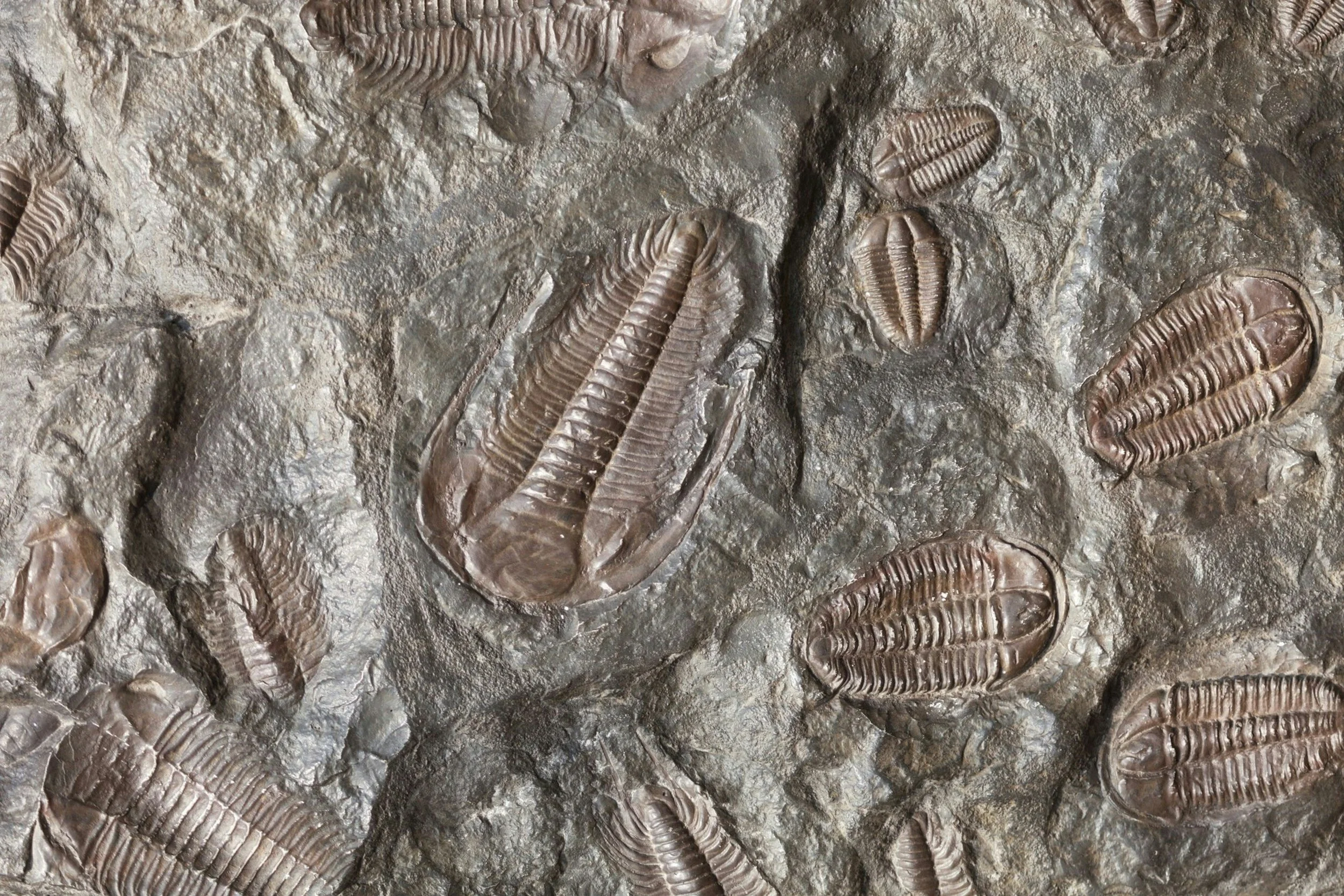
Trilobite Search: Examine the fine-grained, darker shale sheets immediately bordering the volcanic rock. With a keen eye, you can find the delicate, segmented head-shields and tails of trilobites—the iconic, armored scuttlers of the ancient seas—cast permanently into the mudstone matrix.
Step 4: The Elevated Reef Terraces (The Rytteråker Formation)
The Route: Follow the trail as it loops slightly inland toward the higher crests of the southern peninsula before terminating near the quiet bays facing Malmøykalven.
What to Look For: You are now standing on the younger Rytteråker Formation. The rock here is dense, hard limestone that once formed a shallow, sunlit reef system. Look for honeycomb patterns in the rock—these are the fossilized remains of favosites (chain corals) and massive, layered stromatoporoid sponges that basked in equatorial waters millions of years before the dawn of the dinosaurs